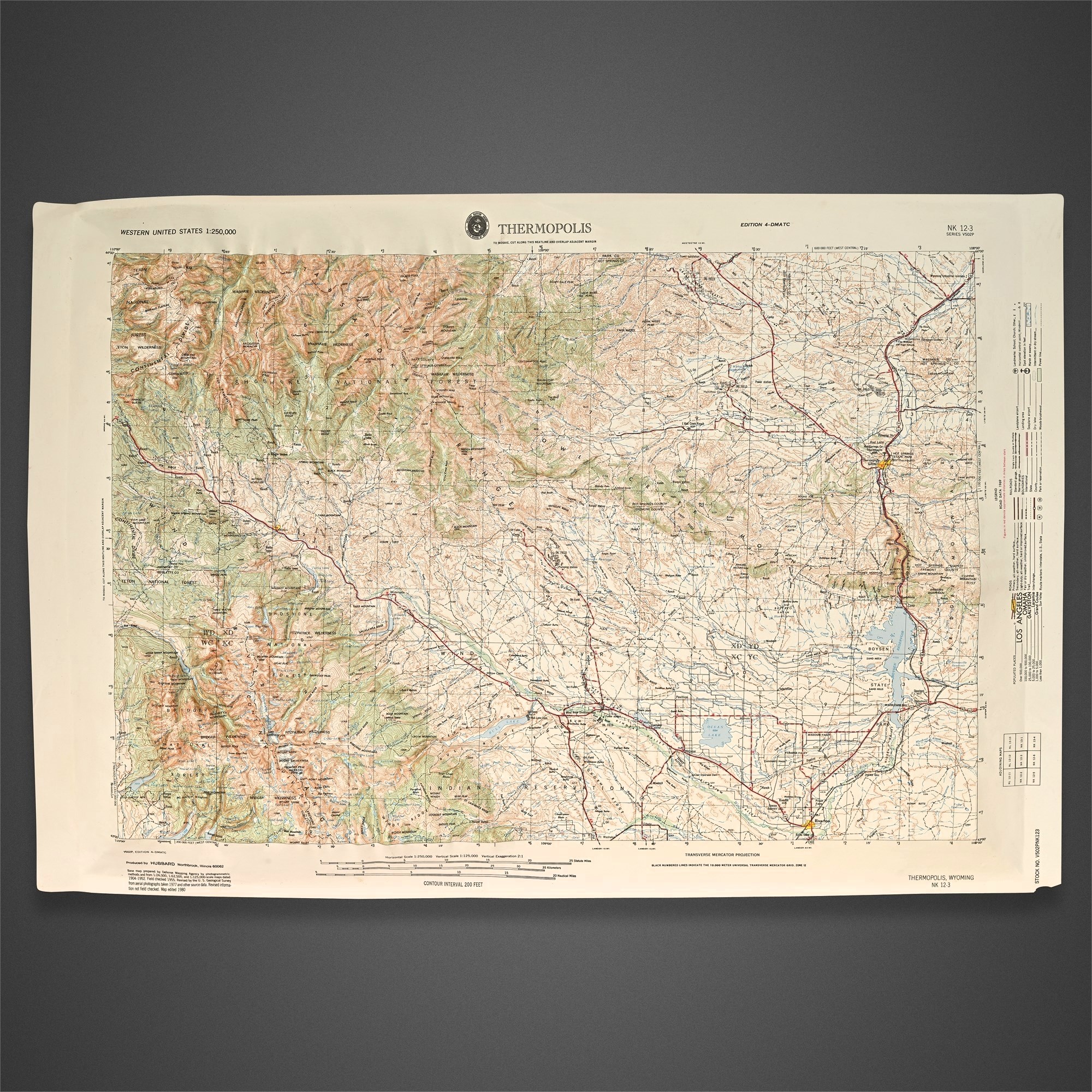
Thermopolis Wyoming DMA Relief Map 1980 NK 12-3 View Watchlist >
- Winning Bid: $41.00
- 12 Bid(s) View Bid History
- High Bidder: edall
Seller Accepts Credit Cards
Payment and pickup instructions will be available on your invoice (under "My Account") at the conclusion of this auction.
Lot # B292
System ID # 26413044
Start Date
End Date
1 Watching
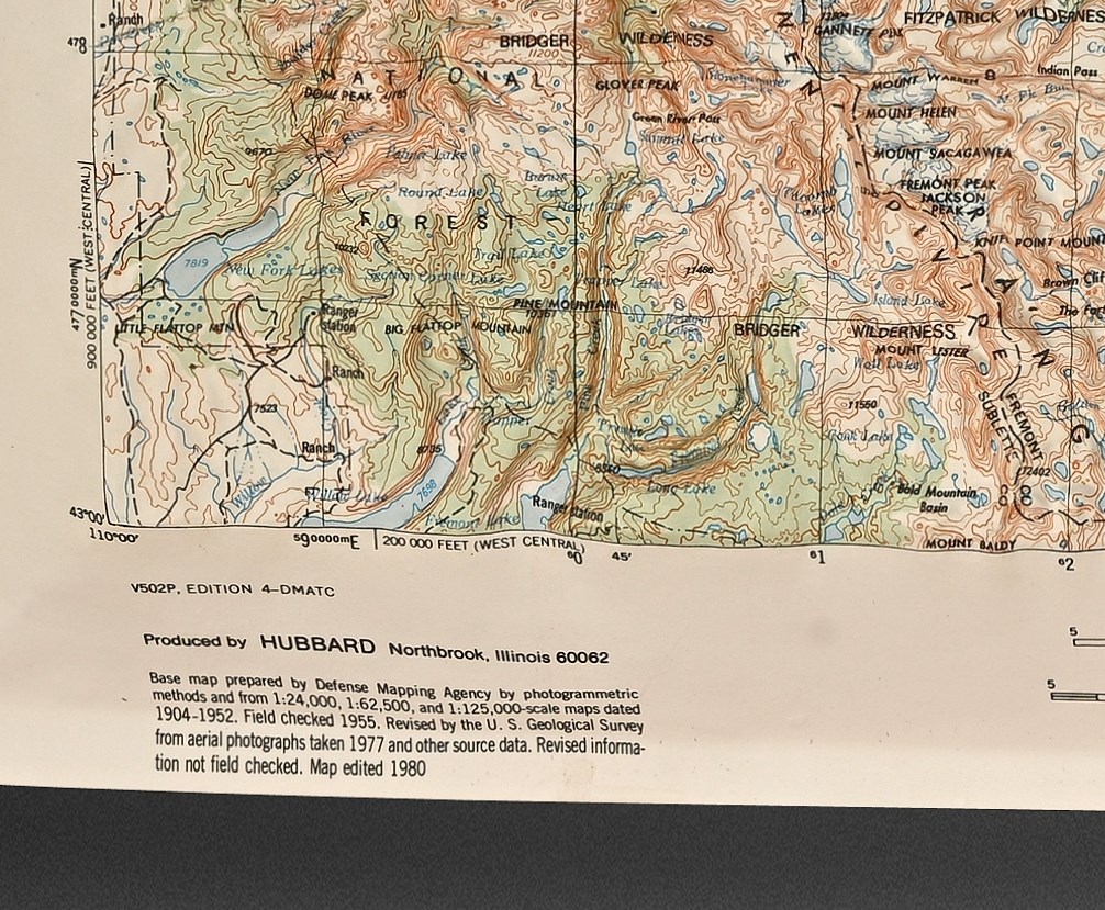
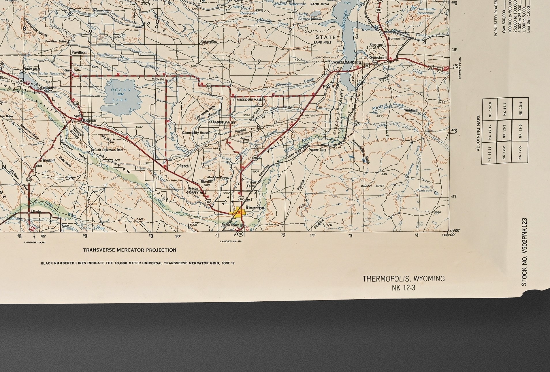
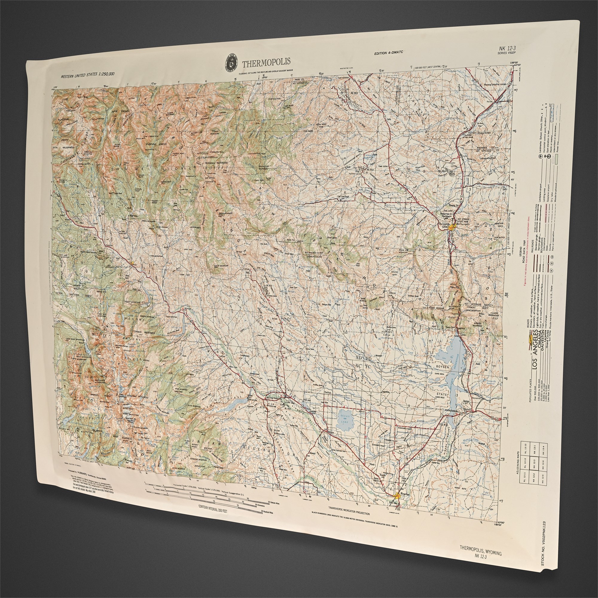
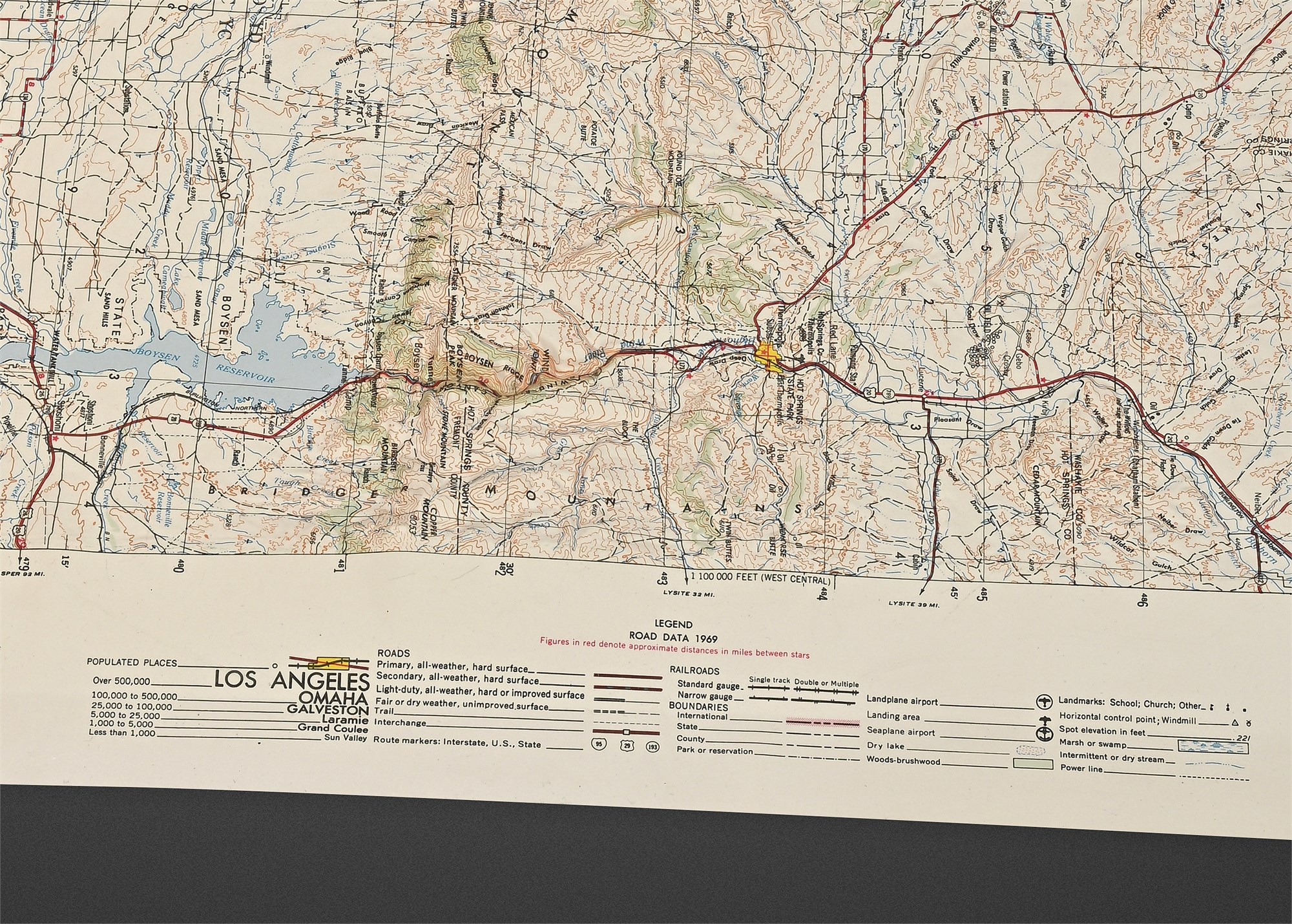
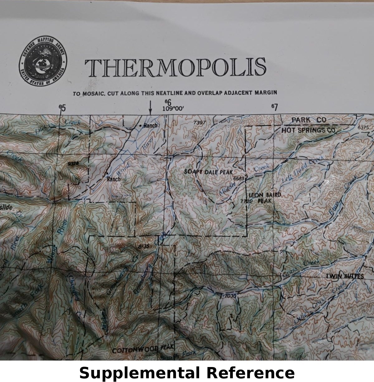
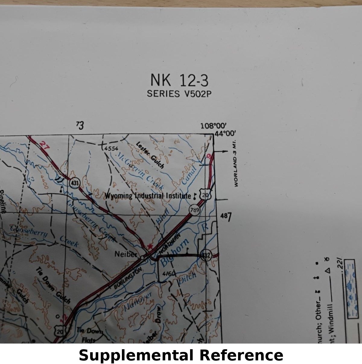
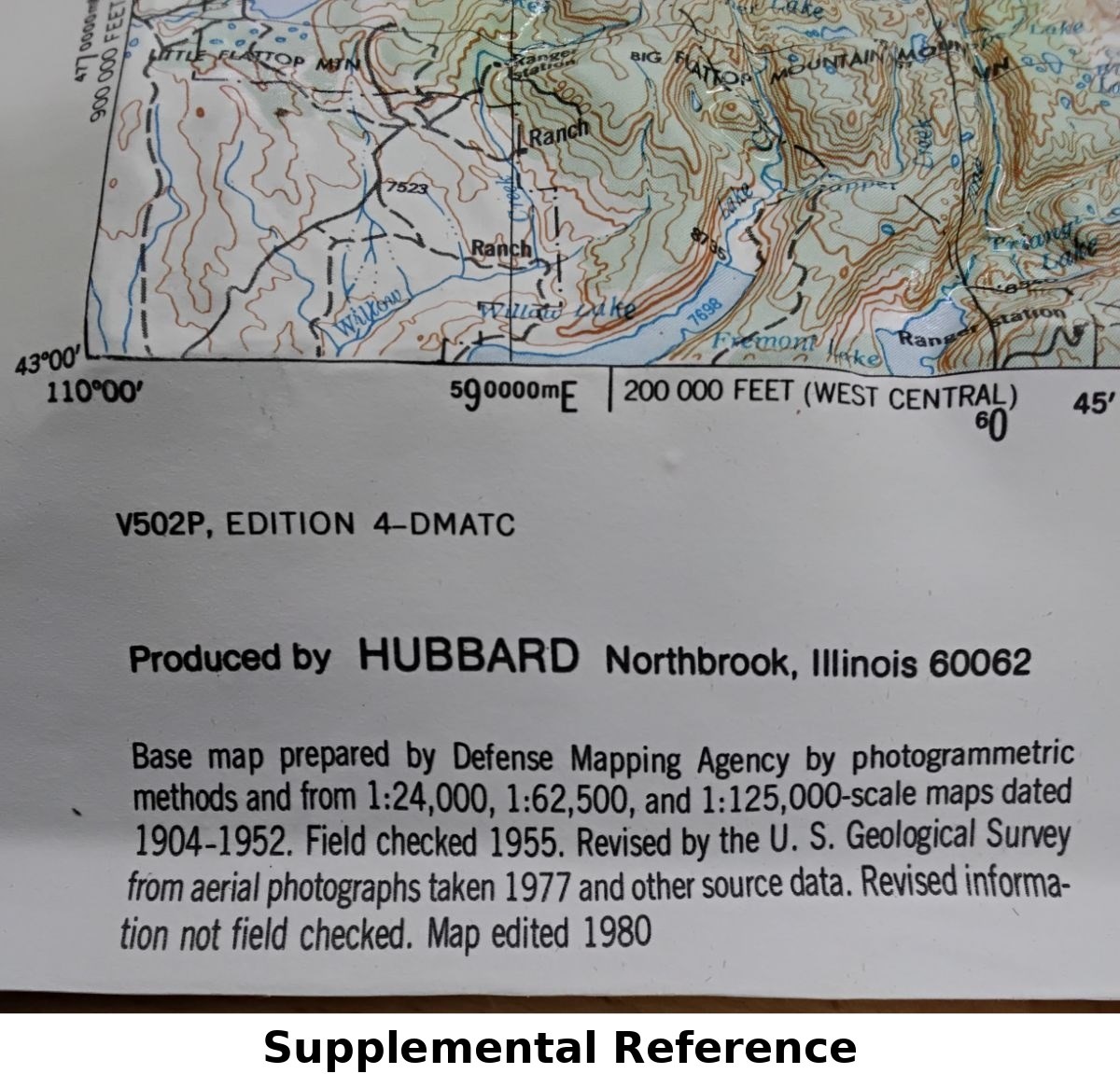
Thermopolis Wyoming DMA Relief Map 1980 NK 12-3
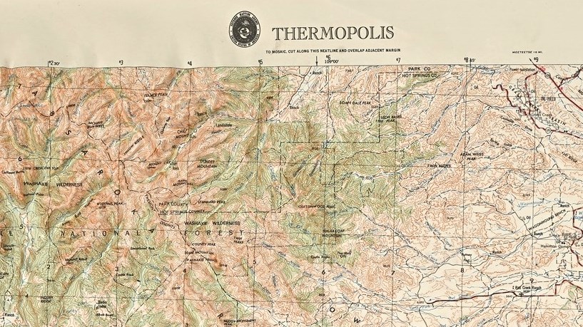
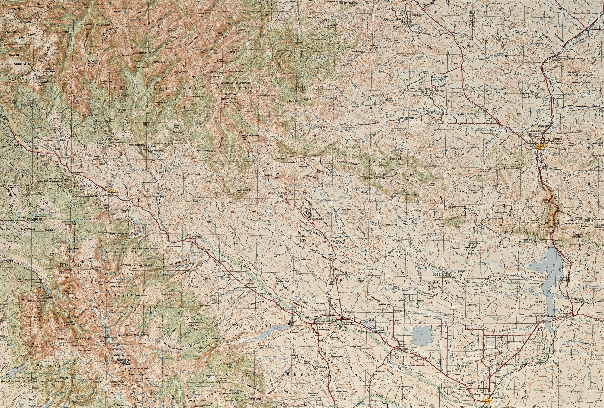
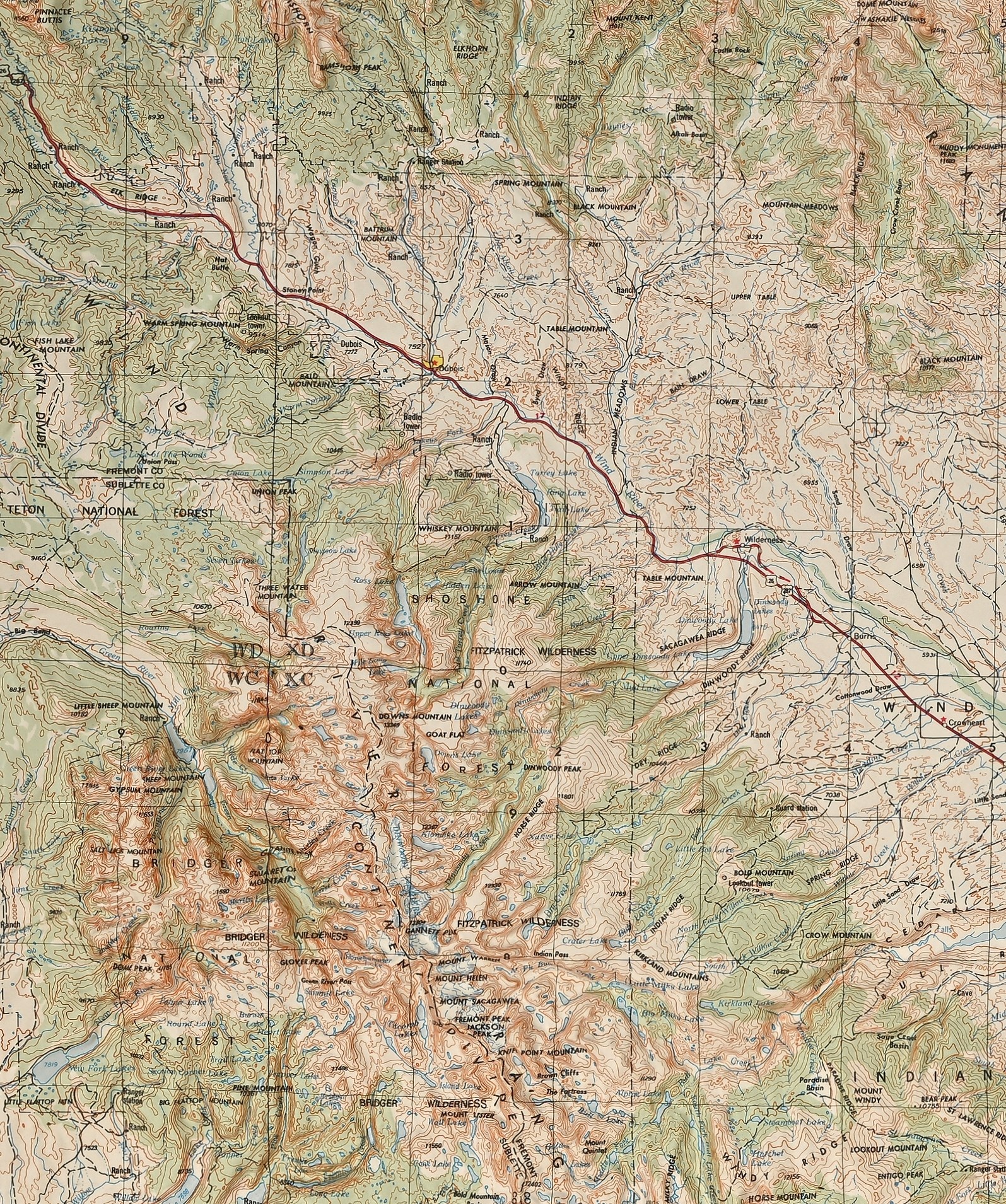
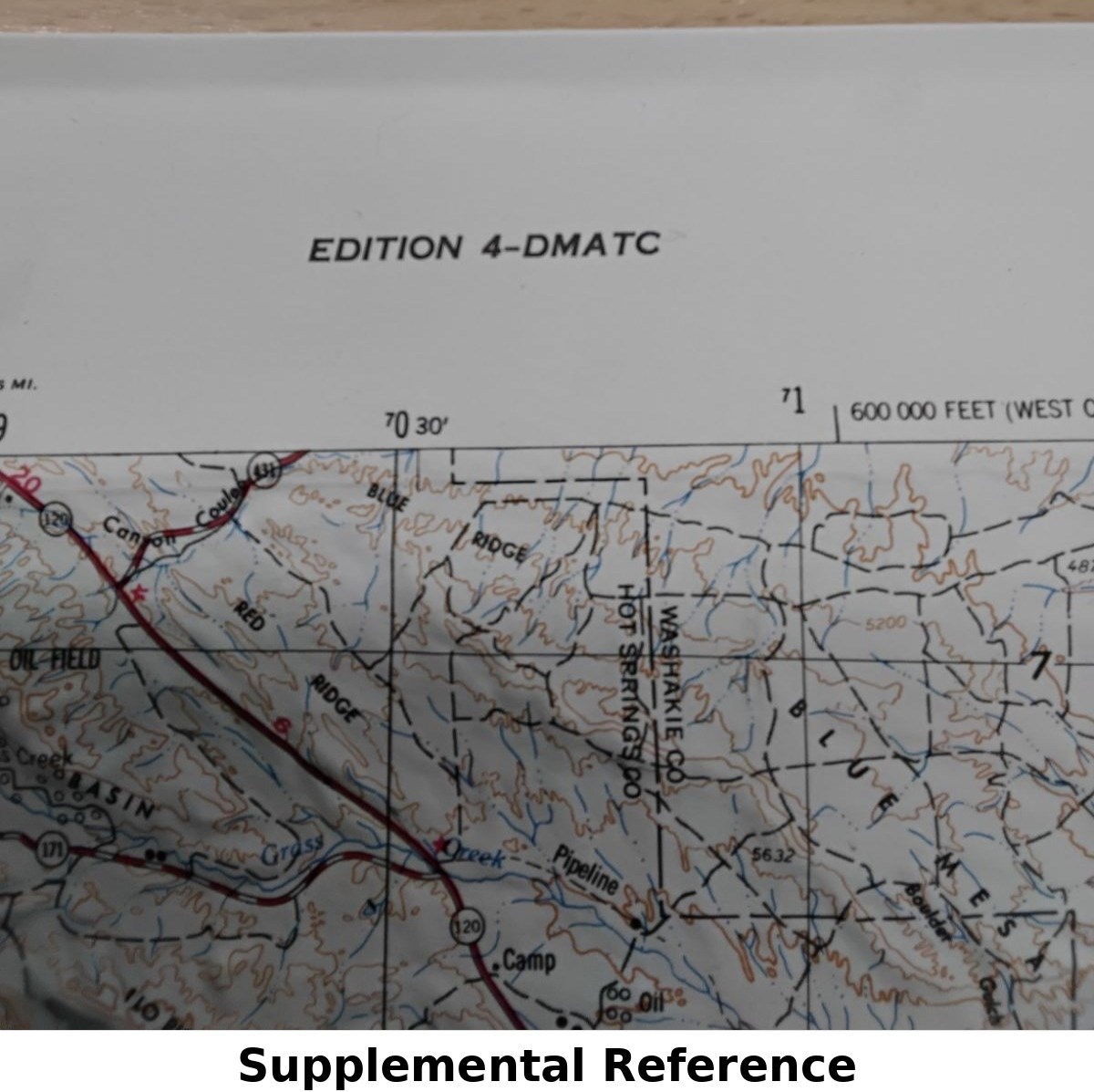
Raised relief topographic map of Thermopolis, Wyoming, issued by the Defense Mapping Agency (DMA), Series V502P, Edition 4-DMATC, map edited 1980. This three-dimensional molded map depicts Hot Springs County and surrounding terrain with pronounced elevation detail, contour modeling, rivers, highways, and township grids clearly represented.
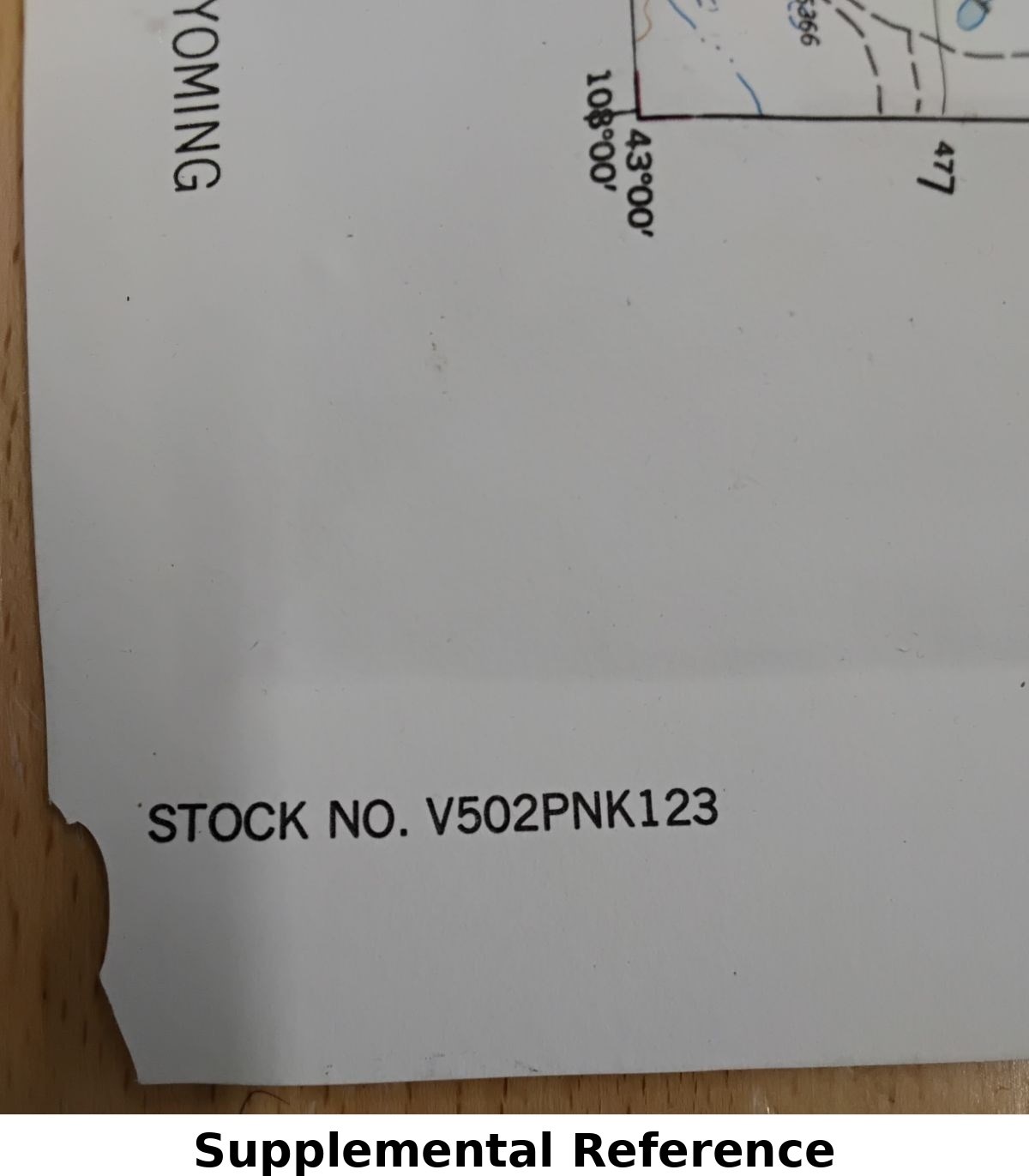
Maker marked along the margin with series designation NK 12-3 and stock number V502PNK123. Produced by Hubbard, Northbrook, Illinois. A striking Cold War–era cartographic display piece, ideal for collectors of Western Americana, military mapping, or geographic décor.
Condition
Good overall condition with a .75" crack/chip to the lower right corner as shown. Light surface wear consistent with age. Relief surface remains structurally sound and visually strong.
Dimensions
21" x 31" x 1" (Height x Width x Depth)