Ruidoso NM Wildland Fires Map 1911–2024 by Bad Hoss Map Co View Watchlist >
- Winning Bid: $230.00
- 19 Bid(s) View Bid History
- High Bidder: BrendaMendoza234
Seller Accepts Credit Cards
Payment and pickup instructions will be available on your invoice (under "My Account") at the conclusion of this auction.
Lot # A614
System ID # 26013538
Start Date
End Date
3 Watching
Ruidoso NM Wildland Fires Map 1911–2024 by Bad Hoss Map Co
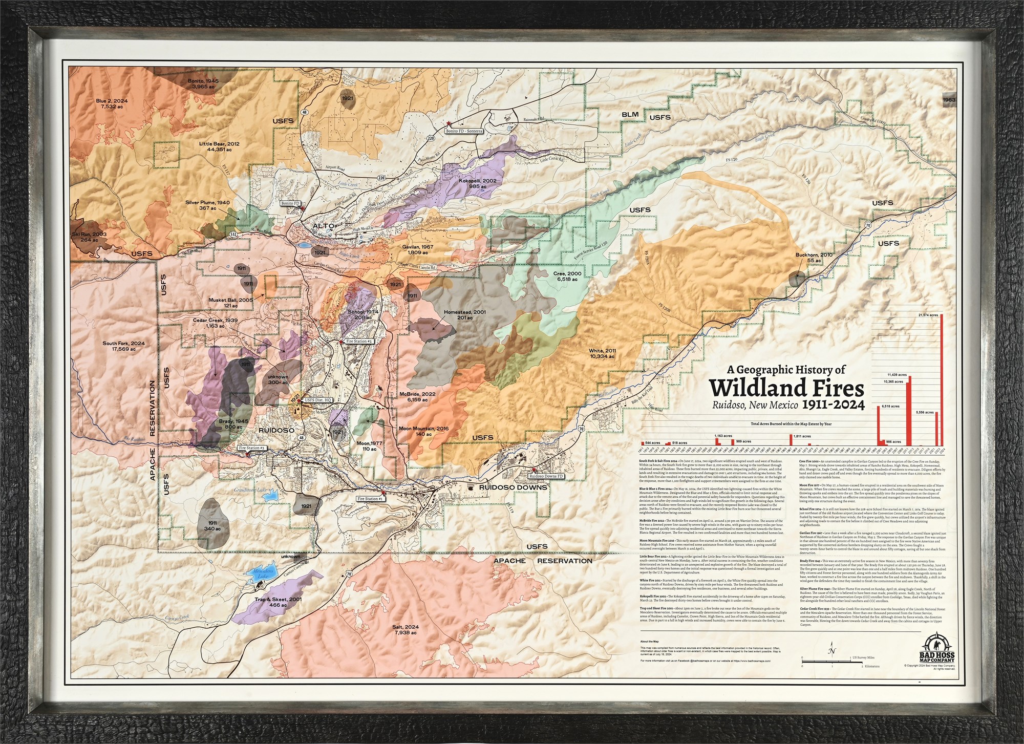
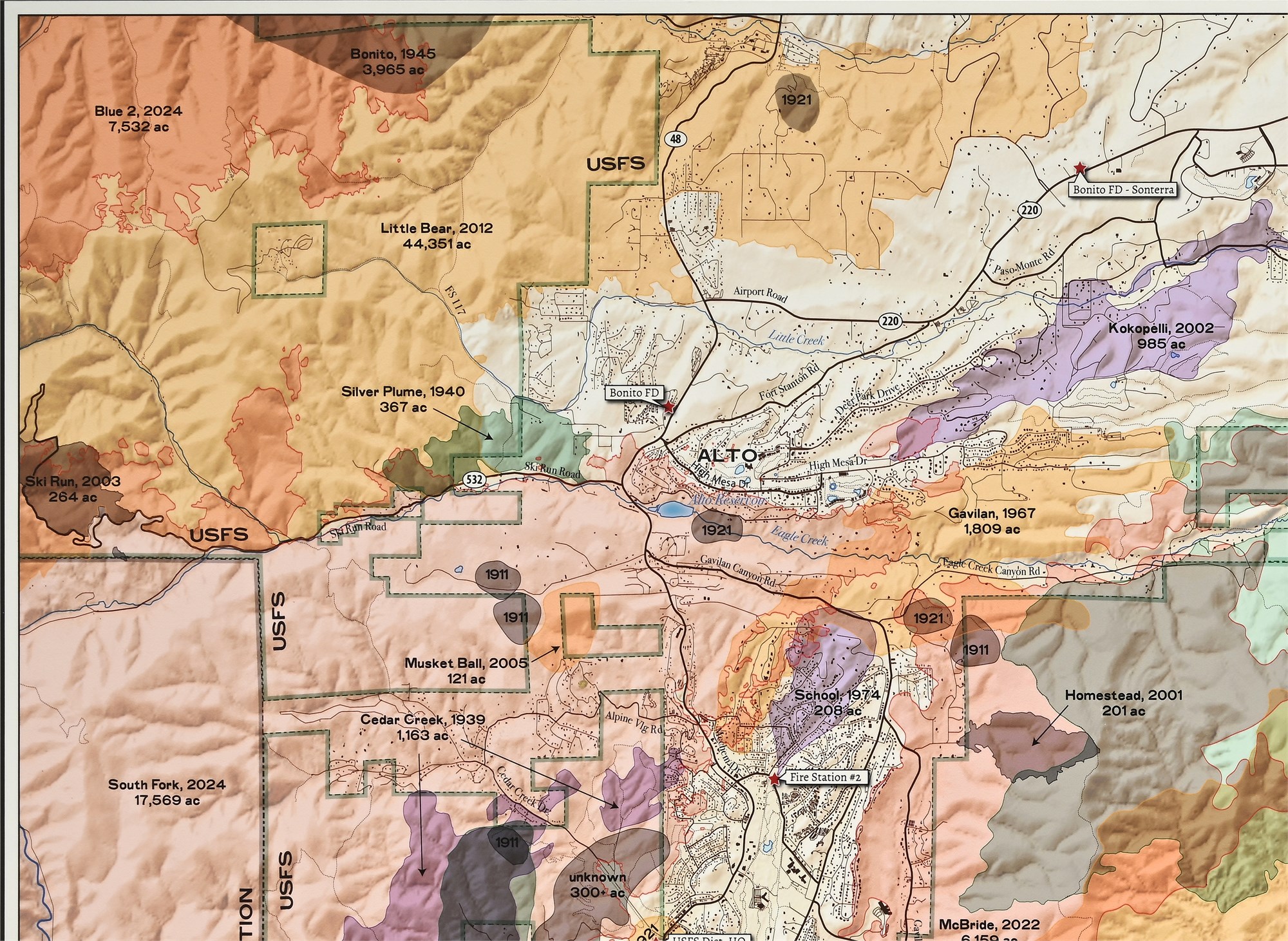
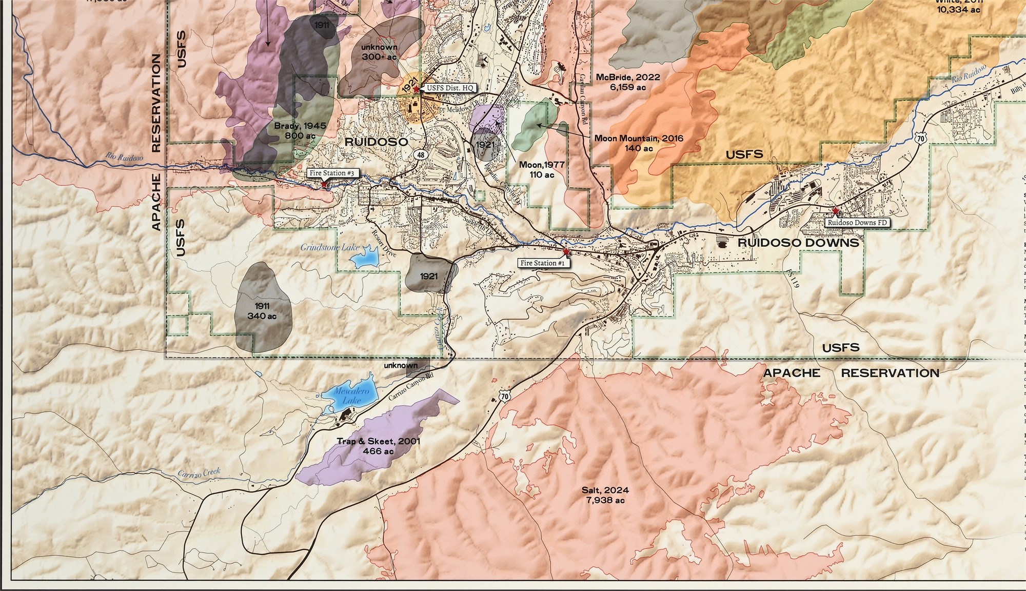
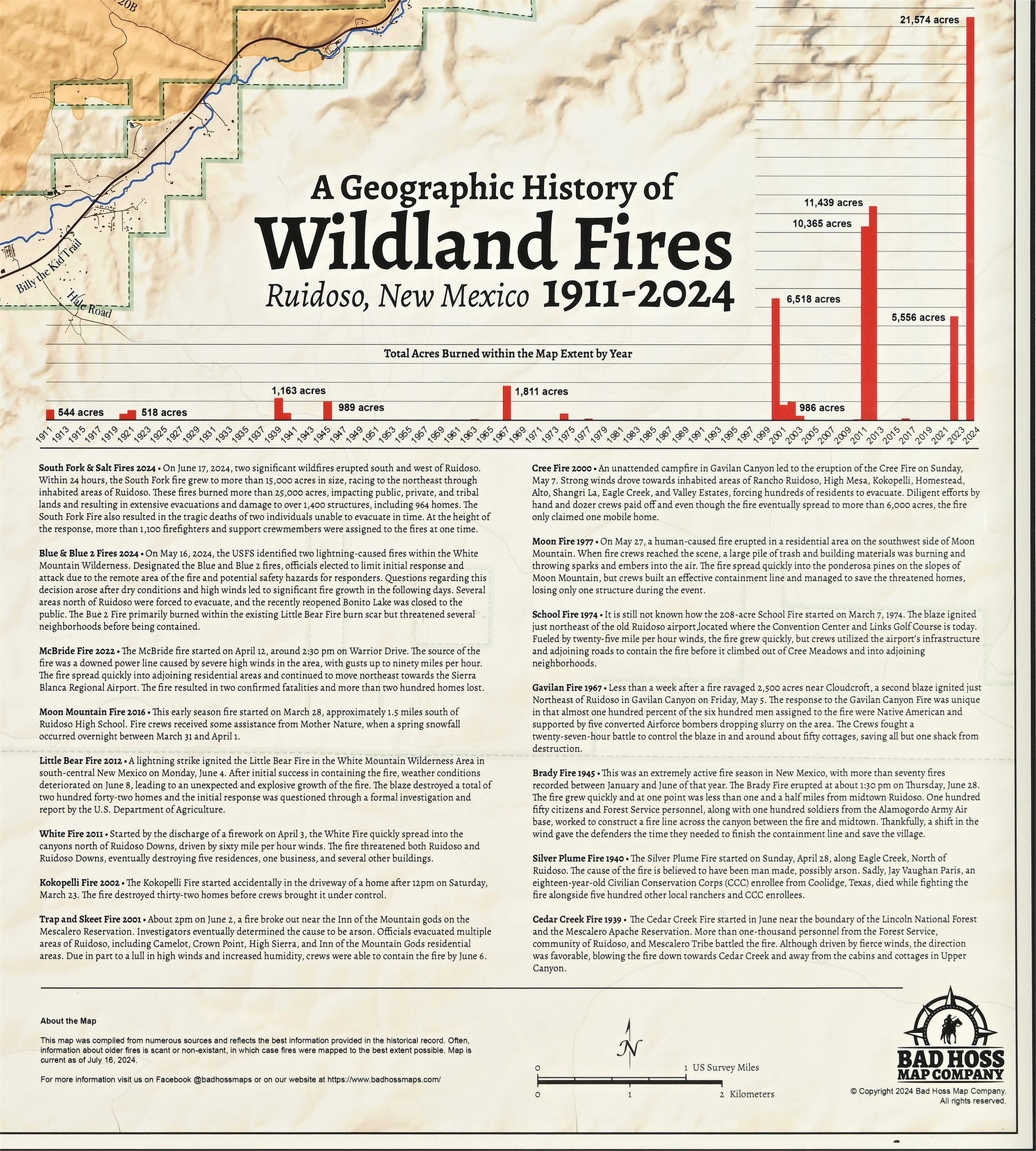
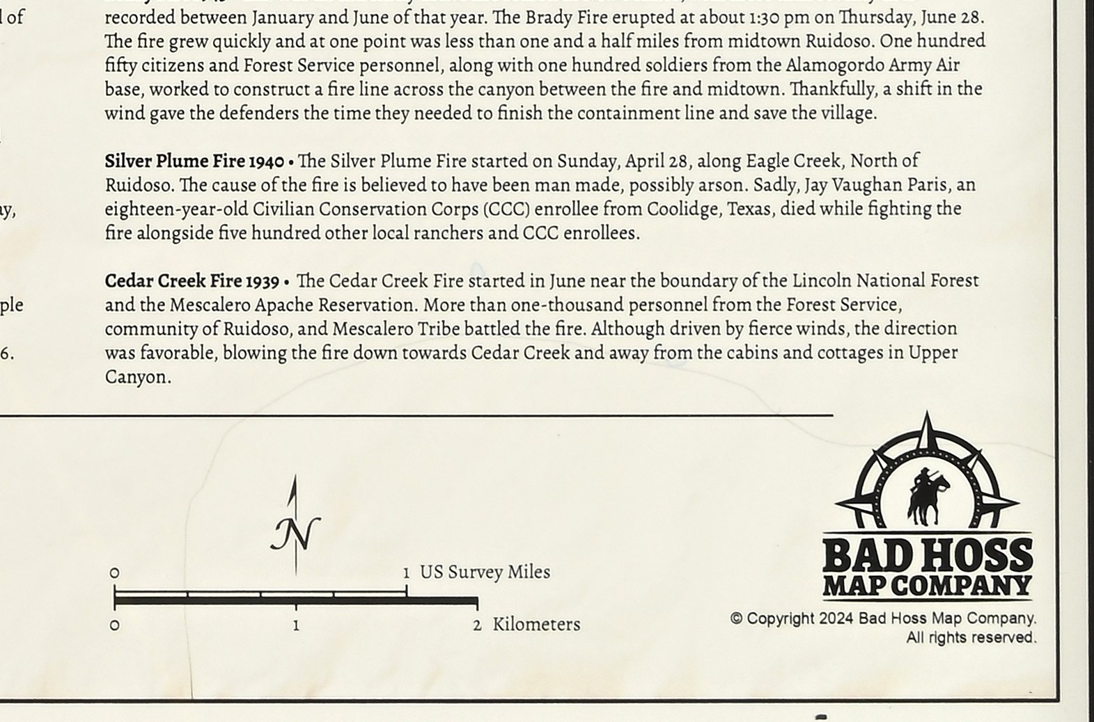
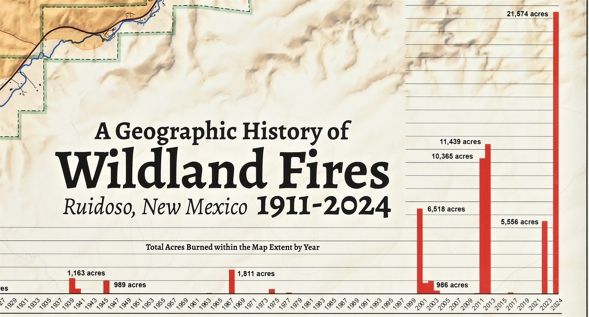
This framed wall map titled “A Geographic History of Wildland Fires – Ruidoso, New Mexico 1911–2024” was produced by Bad Hoss Map Company and copyrighted in 2024. It documents more than a century of wildfire history that has directly shaped the communities of Ruidoso, Alto, and Ruidoso Downs, giving the piece strong regional significance.
The map features color-coded wildfire perimeters layered over detailed topographic terrain, clearly identifying burn areas, dates, and acreage totals across USFS lands, Apache Reservation boundaries, roadways, waterways, and town infrastructure. A timeline chart tracks total acres burned by year, while extensive historical text entries provide context on major fire events and their impact on the region. Both educational and commemorative, this map serves as an important visual record of the area’s environmental history and resilience, making it especially appealing to local collectors, institutions, or residents with ties to the region.
Condition
Excellent condition with no damage. The map surface is clean and crisp with no visible creases, tears, stains, or frame issues. Displays exceptionally well.
Dimensions
Overall: 30 1/2 x 42 1/2 x 1 1/2 inches