Civil War Map & Capitol View – Virginia to Manassas, c.1861, Framed View Watchlist >
- Winning Bid: $55.01
- 15 Bid(s) View Bid History
- High Bidder: DrTom
Seller Accepts Credit Cards
Payment and pickup instructions will be available on your invoice (under "My Account") at the conclusion of this auction.
Lot # E458
System ID # 22516017
Start Date
End Date
2 Watching
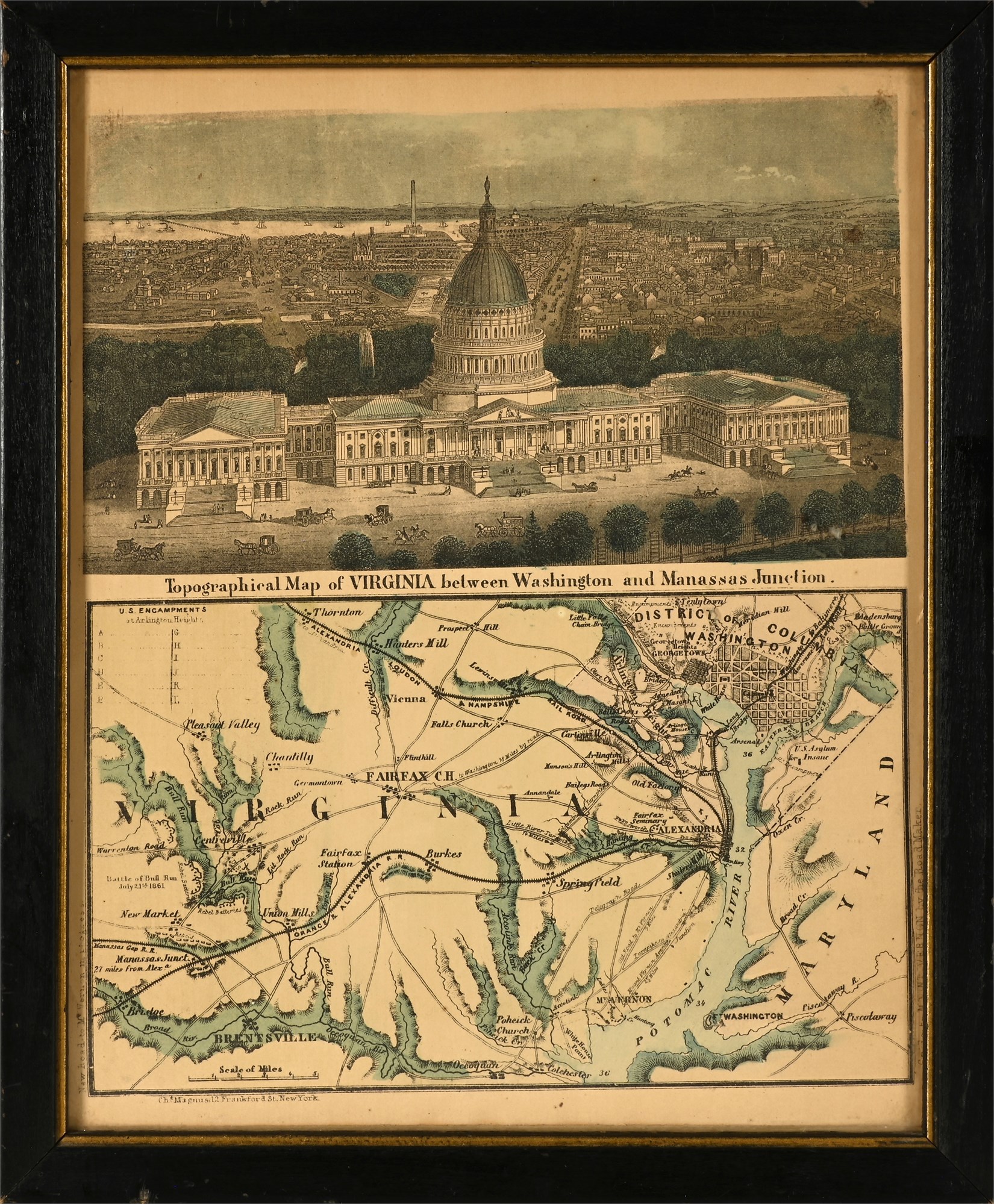
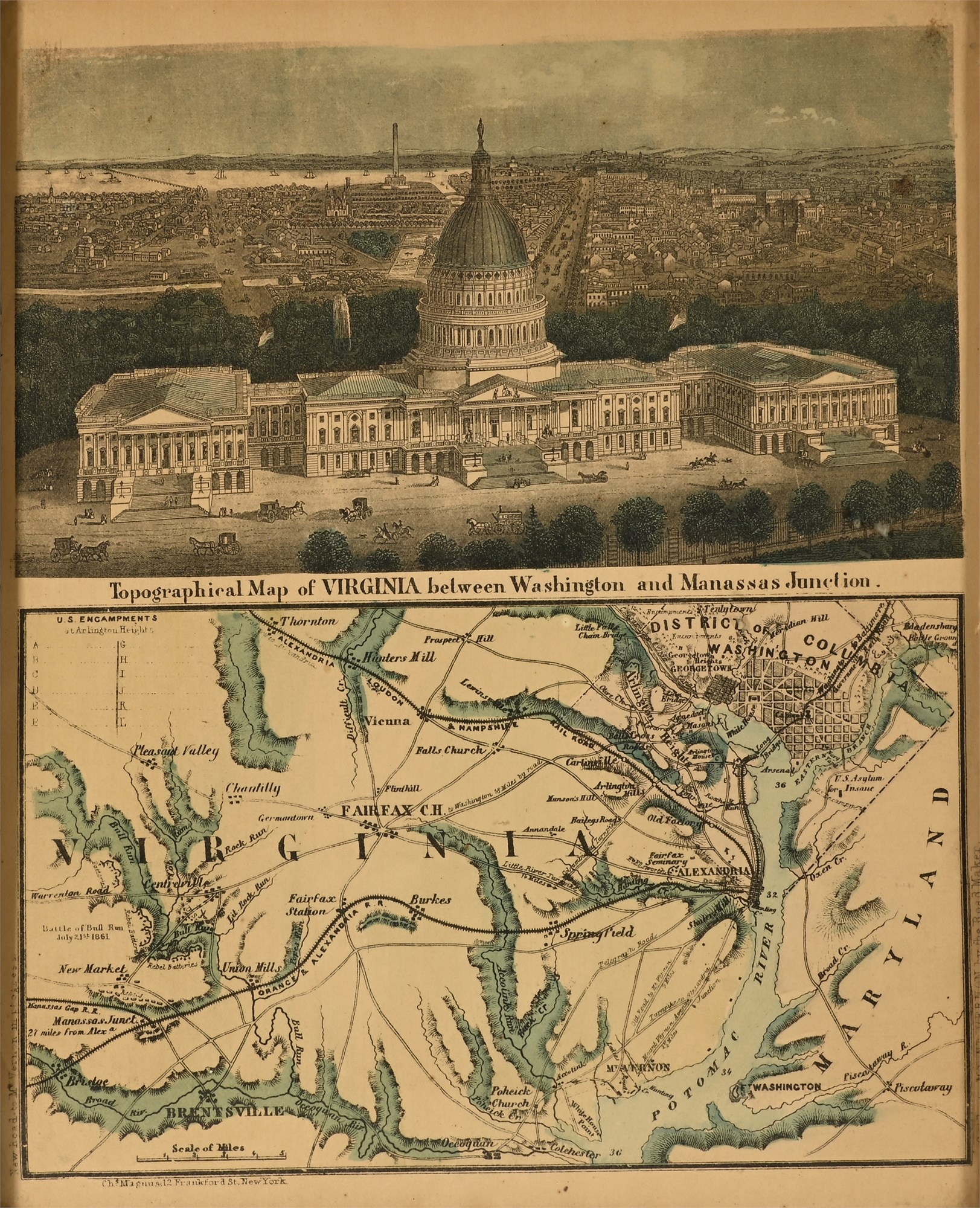
Civil War Map & Capitol View – Virginia to Manassas, c.1861, Framed
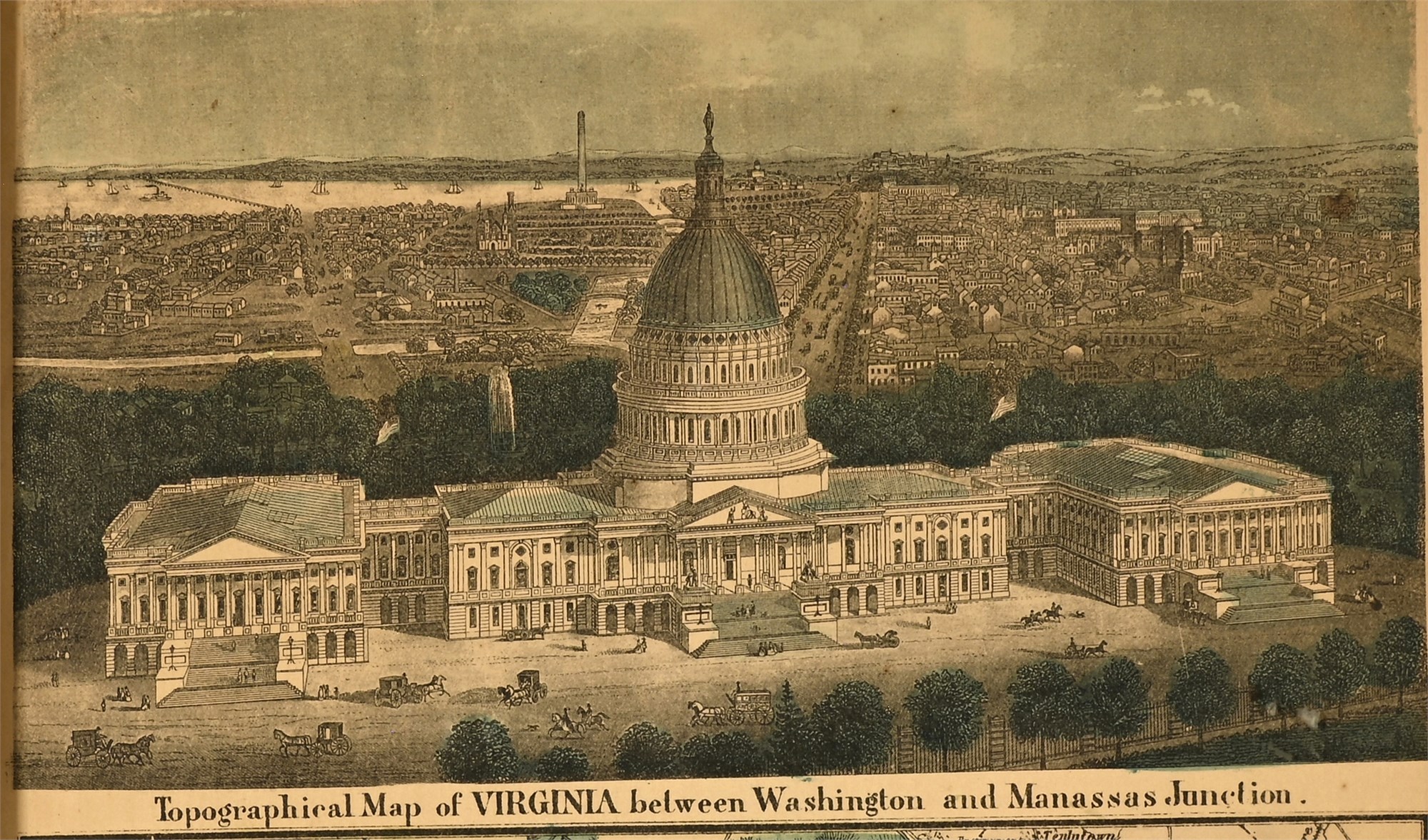
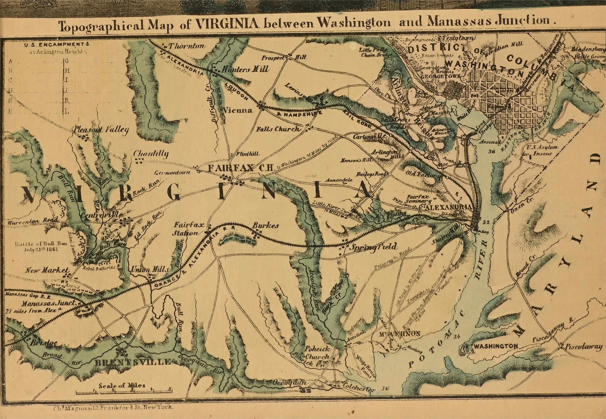
Striking Civil War-era lithograph combining a detailed map of Northern Virginia with an elevated view of the U.S. Capitol under construction. The lower panel features a Topographical Map of Virginia between Washington and Manassas Junction, highlighting key Civil War sites such as Arlington Heights, Fairfax, and Manassas (notably marking the First Battle of Bull Run, July 21st, 1861). Above, a colored engraving depicts the Capitol building and surrounding Washington, D.C., skyline with the dome partially completed—dating the piece to around 1861–1862. Railroads, rivers, and encampments are carefully illustrated, providing historical insight into Union strategy and movement.
A compelling piece for collectors of Americana, Civil War memorabilia, or antique cartography.
Condition
In good condition overall, with some wear visible. The print shows light toning consistent with age. Frame exhibits surface scuffing but remains intact and protective. Please review images for details.
Dimensions
Overall: 10.75 x 9 inches