1854 “Map of Pennsylvania” by Thomas, Cowperthwait & Co. — Hand-Colored, Framed View Watchlist >
- Winning Bid: $120.00
- 25 Bid(s) View Bid History
- High Bidder: eljebel549
Seller Accepts Credit Cards
Payment and pickup instructions will be available on your invoice (under "My Account") at the conclusion of this auction.
Lot # E449
System ID # 22514479
Start Date
End Date
0 Watching
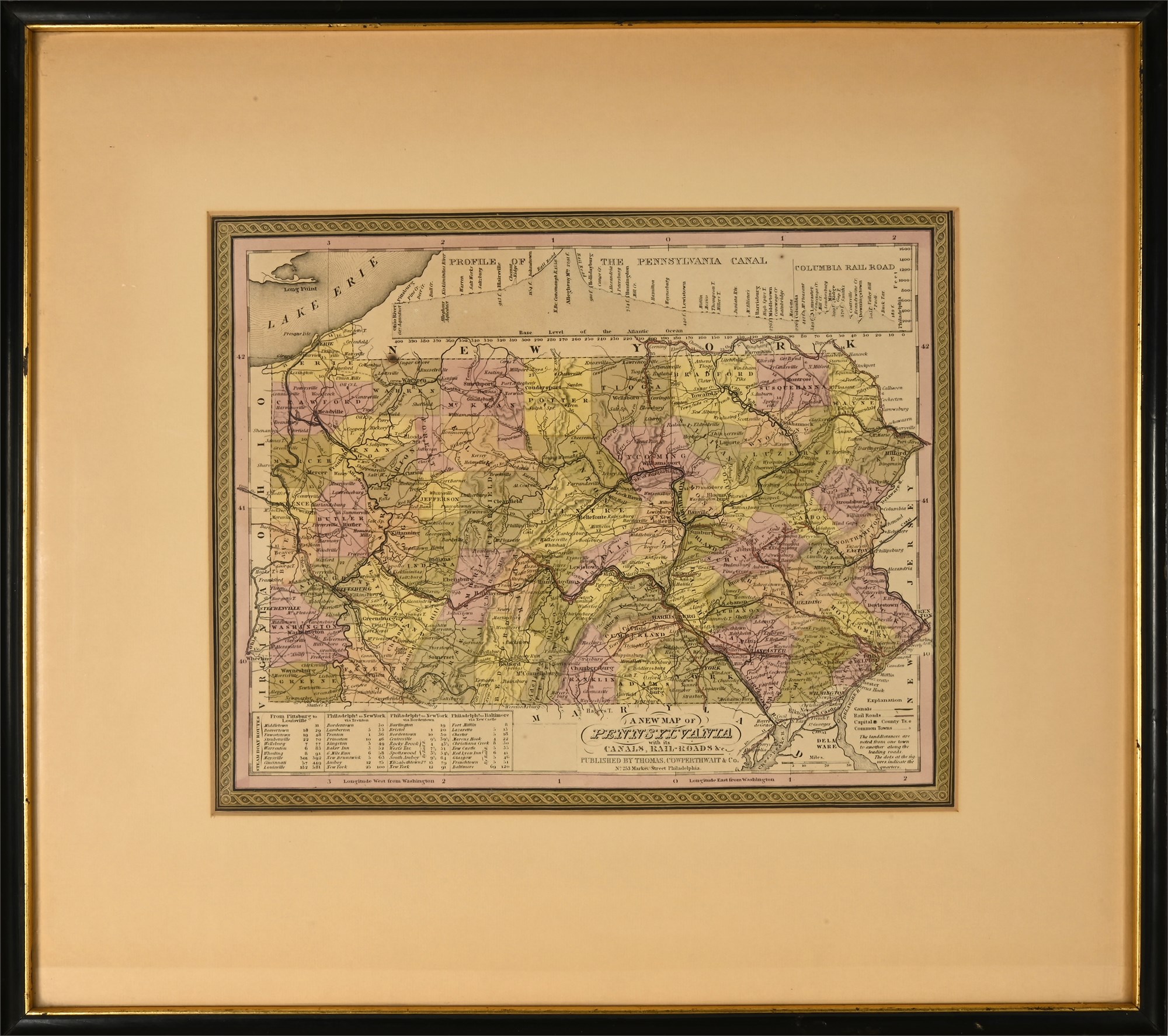
1854 “Map of Pennsylvania” by Thomas, Cowperthwait & Co. — Hand-Colored, Framed
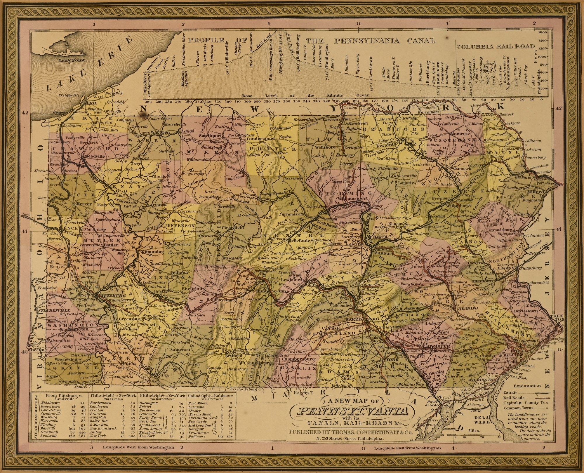
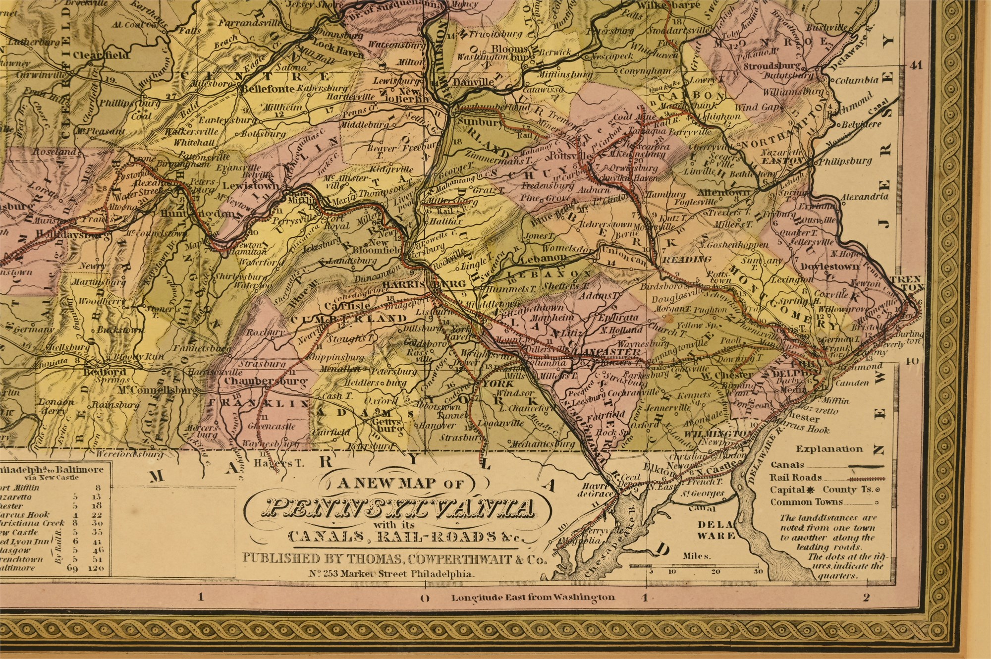
This is an original 1854 hand-colored map of Pennsylvania, titled “A New Map of Pennsylvania with its Canals, Rail-Roads, &c.”, published by Thomas, Cowperthwait & Co. of Philadelphia. Issued during a period of rapid infrastructure growth, the map highlights Pennsylvania’s extensive network of canals and railroads—both operational and proposed—alongside clearly delineated county boundaries in pastel wash tones.
Key cities such as Philadelphia, Harrisburg, Pittsburgh, and Erie are prominently labeled. A detailed inset across the top edge displays a profile of the Pennsylvania Canal and Columbia Railroad, graphically depicting elevation changes along this major commercial route. Tables at the bottom margin list mileage distances from Philadelphia to surrounding towns, reflecting 1850s travel routes.
Produced with fine engraving and vibrant hand-coloring, this map is typical of the high-quality atlas prints issued by Cowperthwait, a successor to H.S. Tanner and a major mid-century Philadelphia map publisher. It is professionally framed under glass in a black and gilt-accented wooden frame with wide matting.
Condition
In good condition overall. The map surface is clean and undamaged with strong color retention. Matting shows minor toning from age, but does not detract from presentation. Frame remains structurally sound with only minimal surface wear.
Dimensions
-
Overall (framed): 20 x 22 inches
-
Visible map area: 12 x 14 inches