1854 Map of New Jersey by T. Gordon / Thomas, Cowperthwait & Co. — Hand-Colored View Watchlist >
- Winning Bid: $49.00
- 25 Bid(s) View Bid History
- High Bidder: karensb
Seller Accepts Credit Cards
Payment and pickup instructions will be available on your invoice (under "My Account") at the conclusion of this auction.
Lot # E448
System ID # 22514335
Start Date
End Date
0 Watching
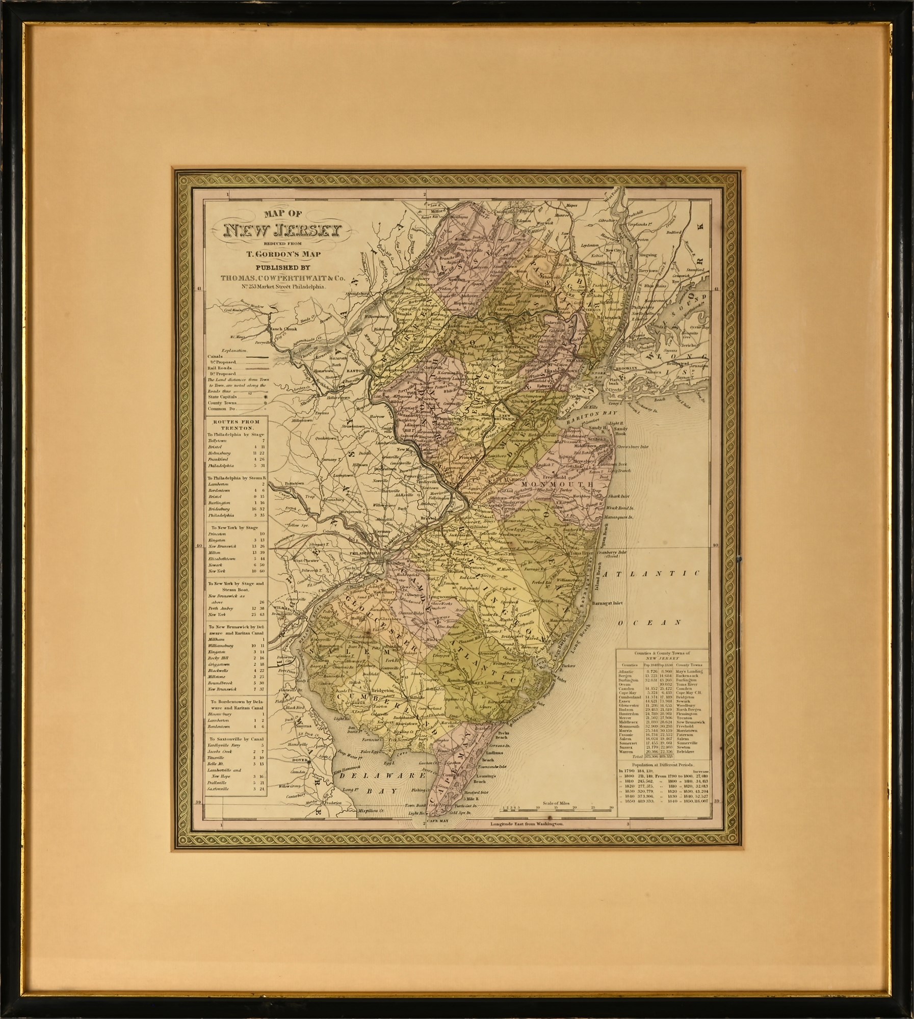
1854 Map of New Jersey by T. Gordon / Thomas, Cowperthwait & Co. — Hand-Colored, Framed
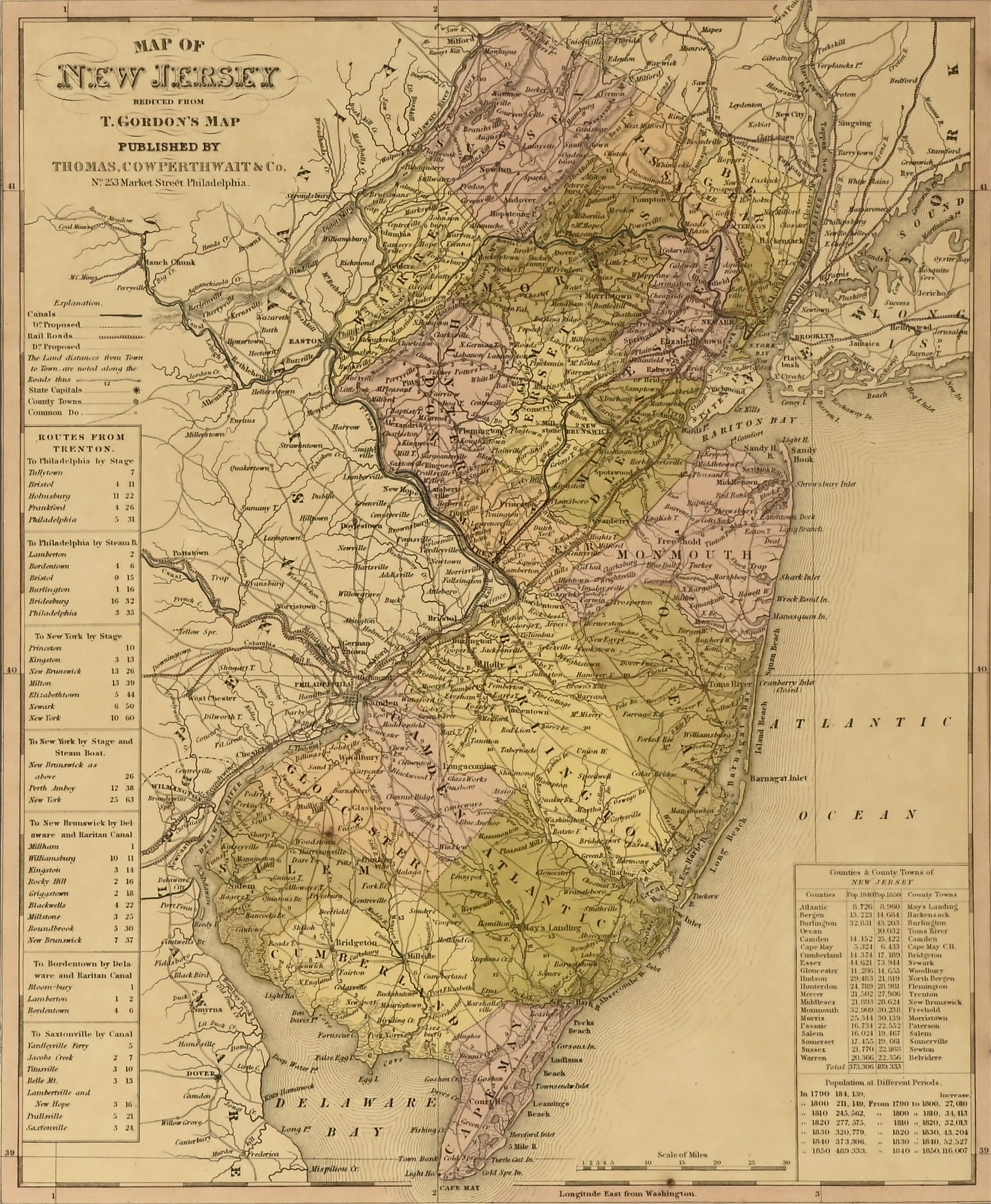
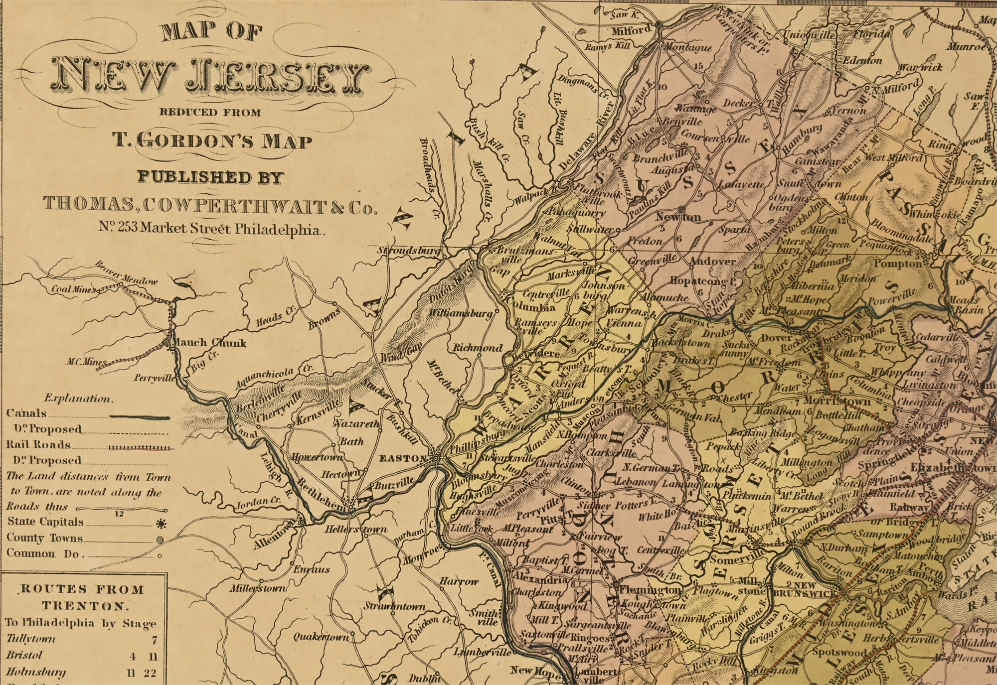
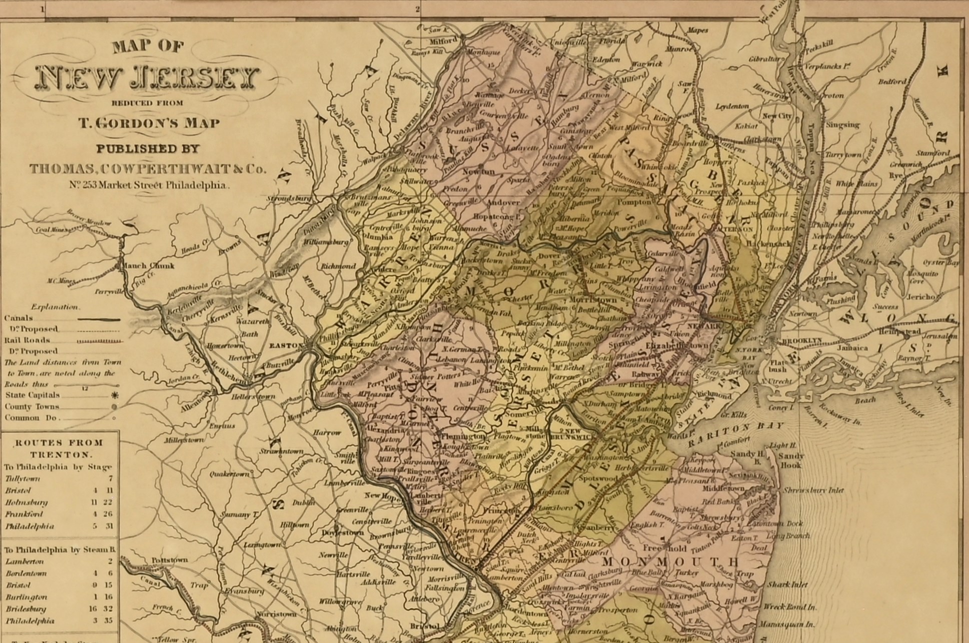
This is an original 1854 hand-colored map of New Jersey, reduced from T. Gordon’s authoritative state survey, and published by Thomas, Cowperthwait & Co. of Philadelphia. This detailed state map appeared in mid-century editions of Mitchell’s Universal Atlas and captures the evolving transportation infrastructure of antebellum New Jersey.
The map outlines county boundaries in soft wash tones and features an extensive network of railroads (proposed and existing), canals, and stagecoach routes. Tables include travel distances from Trenton, and a statistical inset provides population data by county from the U.S. Census (1790 to 1850). The typography, engraved detail, and careful hand-coloring reflect the high production standards of Thomas, Cowperthwait & Co., successors to H.S. Tanner and close associates of S. Augustus Mitchell.
Condition
In good condition. The map remains clean and intact with bold original coloring. Light toning is present throughout, consistent with age. The frame shows slight surface wear to the finish, but remains structurally sound and attractive. Display-ready with glass and matting in place.
Dimensions
- Overall (framed): 22 x 20 inches
- Visible map area: 15 x 12 inches